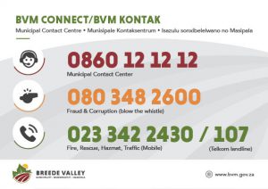
Geographical Information Systems
An interactive map viewer allows the user to locate and identify both farm and urban properties as well as other points of interest and services. These include but are not limited to things like schools, police stations, fire stations, etc. The viewer also allows the user the ability to query properties in terms of extent and zoning.
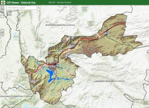
Click here to view interactive map
Select category or search...